 |
| Tenerife - Day 1 |
Chamorga Circuit on Garmin Connect | Hill above San Ingueste on Garmin Connect
On Day 1, I went right up into the far north east corner thinking it might be interesting. In fact it was pretty grim with scruffy little shanty towns, twisting roads, thick mist and rain.
I drove down to the north coast at Taganana and Benijo, but these places were awful. Complete bandit country, so I just turned the car around and headed for the end of the road at Chamorga. This place wasn't much better, but at least there was a small bar where I could get a coffee and sit down for a few minutes.
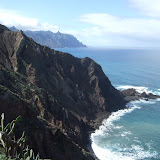
The scenery didn't look too inspiring, but it had more or less stopped raining so I decided to go for a short run around the north eastern most tip of land, down to El Draguillo past the Roque de Dentro to Faro de Anaga to Roque Bermejo and back to Chamorga. This was actually a fairly pleasant run. And about the only person I saw was some scumbag bandit with a shotgun and hunting dogs who was blasting away at what little remaining wildlife there might be.
There was nothing to hang around in Chamorga for, so I drove to Igueste de San Andres to go up a small 426m hill with quite a fine outlook. There was no real path along the summit ridge, so I ended up thrashing through the jaggy undergrowth. I didn't see anyone else on the hill apart from another scumbag bandit with a shotgun and hunting dogs, blasting away indiscriminately at wildlife and bits of tree. I didn't feel entirely safe descending the hill to Lomo Bermejo where more scumbag bandits were blasting away with their guns. It felt all a bit too spaghetti western for my liking.

