Showing posts with label Spain. Show all posts

Friday, 27 March 2009

La Palma

23rd to 30th March 2009
Slideshows: Day 1 | Day 2 | Day 3 | Day 4 | Day 5 | Day 5 (II) | Day 6 | Day 7

A week of trail running on La Palma in the Canaries, based at Santa Cruz. I haven't been anywhere with such diverse landscape, climate and vegetation in such a small area.
All Photos

Hiking trail maps
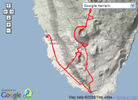
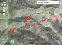
La Palma trail map Day 1 - Pico de la Nieve at EveryTrail Day 2 - La Palma Southern Volcanoes at EveryTrail Day 3 - Ruta de los Volcanes at EveryTrail

Day 1, 23rd March - Manchester to Roque de los Muchachos - Day 1 Photos
Day 1 started with a 4am alarm call at the Cresta Court Hotel, Altrincham to catch the Thomson flight from Manchester direct to Santa Cruz, La Palma. As soon as I arrived I picked up a hire car and dropped my stuff off at La Fuente Apartments where I have been staying this week. The weather was pretty cold, misty and rainy, but I was assured it would be better at the top of the mountain which climbs (by road) to just over 2400m up endless hairpins.

I drove to around 1800m at which point it looked like the mist was about to clear, so I ditched the car and ran up Pico de la Nieve, 2200m, only to discover the summit was in thick freezing fog. Once back at the car I decided I might as well drive up past the astrophysics observatory to the summit of Roque de los Muchachos at 2426m. Things didn't look too promising until I was at the turn off for the telescopes, at which point I suddenly burst upwards out of the mist into blazing sunshine with a sea of mist below.
Pico de la Nieve Roque de la Muchachos - highpoint of La Palma Telescopes above the mist Looking down on the clouds Strange-looking gamma ray telescopes Edge of the World

Day 2, 24th March - Southern Volcanoes - Day 2 Photos
I felt absolutely shattered after my long day yesterday, so it took a while to get going and decide what to do. Eventually I opted for Los Canarios at the south of the island. This gave me a chance to check out the start/finish of Ruta de los Volcanes, plus has some easily accessible recently active volcanoes down at the southern tip of the island.

Day 3, 25th March - Ruta de los Volcanes (twice) - Day 3 Photos
I tried to start reasonable early, and was on the trail at 9.30am from Refugio del Pilar for the famous "Ruta de los Volcanes" along the spine of La Palma down to Los Canarios. The route in one direction is about 17km, but seeing as I only had one car I needed to turn round at Los Canarios and hike the 17km back to the start. A fairly long and very scenic outing of almost 7 hours.

Day 4 - 26th March - Barranco de la Madera and Peurto Espindola
The route around the Barranco de la Madera looks like nothing special on the map, but turns out to be a very special outing indeed. It also has the advantage that you can hike directly from the appartment in Santa Cruz.

I was quite tired from yesterday, so didn't make a particularly early start. The route heads up a dry river bed to Las Nieves before climbing to reach a steep zig-zag trail through pine forest. This climbs to almost 1,000m where you suddenly pick up a dramatic super-exposed narrow trail contouring across the barranco wall following a water channel. The path is no more than a metre wide and has a huge unprotected drop off the side in places. In other places you are grovelling through tunnels in near total darkness.

Eventually just at the head of the barranco you emerge from the final tunnel and the return route is a far more relaxing saunter down the floor of the barranco.

I was back in Santa Cruz with time to kill so took a drive up the winding coast road northwards to Los Sauces where there is a huge new bridge with 135m span and 150m drop to the barranco floor. I drove down a tortuous road to Puerto Espindola to find a very small black beach where it definitely didn't look safe to swim.

I took a look at Los Tilos before heading back, but it was too cold and dark by this stage to bother going for another run.

Day 5 - 27th March - Pico Ovejas and Mirador de la Concepcion
My plan this day was to connect onto the main spine at the Reventon Pass and then head northwards along the mountain tops as far as I could get. Ideally to Pico de la Nieve, and possibly a bit further around the Caldera Rim.

I duly set off from the pretty church of Ermita Virgen del Pino, the only car in the car park, and the weather looking rather iffy. I climbed 500 metres to the pass where it was cold and windy, and as I headed north it almost immediately started hammering down with freezing rain. I was glad I had brought my goretex jacket, but the rain was really pelting down and turning to hail.

As I climbed above 1600 metres the hail was lying on the ground turning the ridge white. My bare legs and hands were taking quite a beating from the rain and hail, but I pressed on, determined to reach a logical turning point. Thankfully I reached the small summit of Pico Ovejas 1854m which gave me an excuse to stop and turn round, now totally soaked and hands stinging.

The 950m descent back to the car didn't take too long, but was quite tricky down greasy sloping rock slabs.

I was back at the apartment just after mid-day, so as soon as the rain cleared I decided to head out again.

I couldn't be bothered to drive anywhere so aimed for the Mirador de la Concepcion - the impressive rock feature towering 400 metres above Santa Cruz - however my maps were distinctly unhelpful in showing how to get there since they don't include the new road blasted across the hillside above Santa Cruz which kept blocking my attempts.

After about 7 wrong turns, I eventually found a rough trail across wasteland to reach the waymarked GR130 trail and a proper route up the hill. I reached the mirador just before the sun sank behind the Cumbre Nueva and took some photos looking down on Santa Cruz, and watching the Tenerife ferry head towards the horizon.

Day 6 - 28th March - Barlovento to Gallegos and Los Tilos Bridge
Once again the weather was grey and gloomy. Not a day for the mountains. The hills were shrouded in thick mist. I opted for something lower level and headed north to Barlovento along the tortuously winding coastal road.

The roads on La Palma are so winding that nobody in their right mind would attempt to drive round the island in a day. I did drive to the summit on the first day, but once was enough for that mind-numbing hairpin descent.

Anyhow, when I reached Barlovento it was cold and raining. I waited a while for the rain to ease off, then jogged out along the GR130 coastal footpath towards Gallegos. The 6km route from Barlovento to Gallegos looks nothing special on the map, but what you can't see is that the path drops in and out of steep-sided heavily overgrown barrancos.

The barrancos are full of lush green vegetation and numerous small flowers, and the trail is steep and greasy. I was quite tired when I reached Gallegos. I stopped for Fanta and shortcake biscuits and vaguely considered continuing, but it was cold and started raining again, so I just headed back the same way to Barlovento.

On the drive back to Santa Cruz I took a break at Los Sauces to check out the Los Tilos Bridge. I ditched the car and walked down the old road into the Barranco del Agua, now bypassed with the bridge. The walk along the old road was far more interesting than I exepcted with great views of the bridge plus terraced banana plantations and palm trees laden with dates.

Day 7 - 29th March - Pico Bejenado and Cascada de Colores
This was my final day of the holiday and thankfully the weather was a little better. I headed west towards Los Llanos though the road tunnel in the middle of the island and turned off at the Caldera Visitor Centre for Pico Bejenado 1854m, the most prominent single hill on La Palma. I drove until the tarmac became dirt track, then ditched the car and started running. There is a higher car park, but it only takes a few minutes to run up the track. The trail then follows a good path through pine forest.

I was getting a little worried at the cloud building up, and realised the summit view would soon be obscured. I had to put my foot down on the climb to reach the top in bright sunshine, but with cloud quickly spilling up from the south. The panaromic summit view of the Caldera Rim is quite awesome. A bit like looking across the Grand Canyon.

As I jogged back down, dozens of walkers were rambling up the hill, but far too slowly to get any sort of view from the summit.

I had one final afternoon left, so opted for a trek into the bottom of the vast Caldera de Taburiente. The access road snakes down a dangerous hairpin road strewn with fallen rocks and boulders from the precipitous hillside. In fact driving down this road was the most dangerous act of the holiday.

I took the trail for the Cascada de Colores which follows the river bed into the Caldera. I stuck to the river bed for as long as possible, until getting knocked back by some deep pools and tricky rock slabs. The trail was OK, but dragged on a bit before I finally came to the bizarre Cascada de Colores - a semi-artifical waterfall down a barricade, with strange bright orange water coloured by mineral deposits.

Monday, 1 September 2008

2 weeks in the Pyrenees

8th to 23rd August

Ellie and I went to the central and eastern Pyrenees for 2 weeks of hiking and dossing around. We started off by flying from Prestwick to Girona on Friday 8th August, then picking up a hire and trying to drive as far as possible towards the hills on Friday night. We made it far as Graus before it was too late and dark to carry on, checked into a basic hostal above a bar and found somewhere to eat.

9th August - Graus to Torla
We followed narrow tortuous roads for a few hours before finally arriving in Torla at the entrance to Ordesa National Park. We pitched the tent and wandered up the River Ara for a swim. Later we hatched a plan for the next few days that would involve the GR11 and GR10, Cirque de Garvanie and the might Ordesa Canyon.

10th August - Torla to Baños de Panticosa
We got up early and packed our rucksacks with sleeping bags, tent, gas, stove, food, etc. for a 4 or 5 trip. We headed north up the road out of Torla until we could strike left into the forest on the GR11 trail running up the Ara valley to Bujaruelo. It was pretty hot and crowded when we reached Bujaruelo. After a brief rest and drink we carried on, quickly leaving the crowds behind, as we headed into the remote and stunning upper Valle del Ara. The head of the valley appears hemmed in on all sides, but the GR11 climbs into a rocky lochan-filled basin before crossing the Collado del Brazato, 2550m. Beyond this col was rough descent to the gleaming Embalse del Brazato reservoir, and then an even rougher descent down endless rocky zig-zags until we popped out at the bizarre Baños de Panticosa spa village. Bizarre because it looks like some sort of futuristic architecture competition, mixed in with a handful of scruffy old original buildings. We downed a couple of well-earned beers before heading to the Casa de Piedra bunkhouse.

11th August - Baños de Panticosa to Pont d'Espagne
Lying fast asleep at 5am, a massive thunderclap jolted me to life and I lay there listening to the rain hammering down, wondering what on earth we would do today. Luckily by 8am the storm had abated, so we departed with some trepidation climbing slowly up the wet greasy path into dank cold misty hills. Bit by bit we gained height on the GR11 to the Embalse de Bachimaña reservoirs, and then climbed higher to cross the Puerto de Panticosa col at 2541m, and then dropped north into France descending to the Wallon Refuge for some lunch, and continued to the Chalet du Clot where we stayed the night. We arrived early so went for a swim and visited the tourist trap of Pont d'Espagne for a couple of beers.

12th August - Pont d'Espagne to Gavarnie
We made an early start on the GR10 from Pont d'Espagne up to Lac de Gaube, then followed an easy trail with the mighty Vignemale looming in front, as far as the Refuge des Oulettes. The weather was rather cool, windy and grey for the 600m climb to the Hourquette d'Ossoue 2734m. We didn't bother making the short steep detour to the Petit Vignemale but carried straight on, dropping to the Refuge Bayssellance for a quick lunch, then carrying on down the valley towards Gavarnie. We stopped at the Refuge les Granges de Holle just overlooking Gavarnie, then dropped into town for a mooch around and to buy some provisions.

13th August - Gavarnie to Torla via Cirque de Gavarnie and Ordesa Canyon
This was without doubt the biggest longest and most exciting day of the holiday that included donkey rides, glacier crossings, walls of death with metal spikes for footholds, massive 5 hour detours to the Goriz Hut and down the entire length of the Ordesa Canyon, and finally catching the last bus from Pradera to Torla with 5 minutes to spare after a 13 hour day on the hill. The beer at the campsite tasted good on this evening.

The rest of the story plus photo galleries will get added when I get round to it. At present I'm finding it difficult to summon the necessary time and enthusiasm to update this blog...

Saturday, 29 March 2008

A Week in Spain

20th to 27th March 2008
6 days hiking and jogging with Ellie in the Sierra de Grazalema and Sierra de las Nieves.

Day 1: Friday 21st March
Grazalema - Benaocaz circuit, 24km
Photos from Day 1

Day 1 Day 1 Day 1 Day 1

For our first day in Grazalema, we gathered our bearings with a straightforward circuit to the village of Benaocaz. The weather was fairly grey and dreary, so didn't show off the surrounds in their best light, and we carelessly missed out the detour to the Salto del Cabrero "goat herder's leap", which apparently was the highlight of the route.

Day 2: Saturday 22nd March
Grazalema to Reloj 1535m, 14km
Photos from Day 2

Day 2 Starting up Reloj Near the summit of Reloj

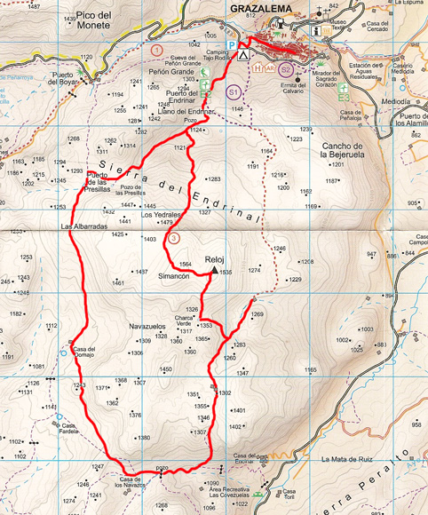
Day 2 started with a visit to the Mirador del Sagrado Corazon viewpoint overlooking the white-washed town of Grazalema. After passing the nearby ruin of Ermita del Calvario we headed straight up into the forest, following a faint trail of yellow arrows that lead to Cancho de la Bejeruela, from where we descended onto a wild scrubby plateau leading across to the imposing rocky mound of Reloj 1535m. There was no discernible path up the hill, so we headed straight up steep-angled rough limestone slabs, making reasonable progress until the weather suddenly turned nasty, with mist dropping and freezing cold gusty wind. After only the briefest visit to the trig pillar, we carefully descended as fast as we could to get the rough sharp limestone. The going was fairly tricky until we finally hit a proper trail that took us quickly down to the Tajo Rodillo campground, nestling below the massive rocky tower of Penon Grande.

Day 3: Sunday 23rd March
Grazalema to Simancon 1564m and Reloj 1535m, 20km
Photos from Day 3

Day 3 Descending Simancon

After baling out of the Reloj - Simancon traverse yesterday, we decided to head back again, this time in the opposite direction, so starting up the trail behind Toja Rodillo campground, and heading up the trail towards Los Yedrales before turning left to ascend the barren rocky peak of Simancon 1564m, which had a reasonable smearing of snow and ice from yesterday afternoon's inclement weather. Today we had no problems in traversing the rock slabs to Reloj 1535m, and then descending the steep south ridge to well at Charca Verde. Here we bumped into three Spanish guys, who were the only people we saw all day on the hill. From here, instead of taking the short easy way back to Grazalema, we decided to continue south to join the trail past Caza de los Navazos, which despite the rather rough trackless descent took us into some fantastic scenery. Lush green valleys surrounded by rocky limestone peaks.

Day 4: Monday 24th March
Navazo Alto 1395m from Villaleunga del Rosario, 13km
Photos from Day 4

Day 4

Since the hire car had been sitting from 3 days unused now, we decided to head round the hills to a new starting point at Villaluenga del Rosario - a grand name for a rather small strangely deserted pueblo blanca. Our initial attempts at gaining the south west ridge of Navazo Alto came to nothing, since despite trashing up the steep hillside through rocks and vegetation, we couldn't find any festige of track, so decided to bale out and hit the main road around to Benaocaz, which meant we were at least doing some running, and we also managed to briefly escape the road on a short section of the GR7 hiking trail. We took full advantage of the drinking fountains in Benaocaz before launching back uptowards Navazo Alto, this time from the north, but the hill looking equally impenetrable, with huge flanks of steep limestone crag. We ended up skirting the entire north side of the hill, until we picked up trail that double-back up the east ridge, and we finally made the summit having circumnavigated the entire hill to get there. The route off was very simple by comparison, as we dropped straight into the back of Villaluenga, with it's huge bullring clearly visible from above.

Day 5: Tuesday 25th March
Montejaque to Cortes de la Frontera, 44km
Photos from Day 5

Day 5

Day 5 was by far our longest outing of the trip, starting from Montejaque, and taking just over 7 hours. We did however stop in Cortes de la Frontera for multiple ice creams before starting out on the return leg to Montejaque, getting frazzled in the strong afternoon sun.

Day 6: Wednesday 26th March
Torrecilla 1919m from Quejigales, 12km
Photos from Day 6

Day 6 On the summit of Torrecilla

Our final day of the trip saw us switching ranges to bag Torrecilla 1919m, the highest peak in the Sierra de las Nieves, and in fact the highest hill in western Andalucia. The lower section of the route was a good trail in scenic, sheltered pine forest, but the upper section was exposed and barren. For the final 100m of ascent, the wind speed increased to the point where speech and standing upright were both almost impossible. Battered by a penetratingly cold wind, we only stayed on the summit for a maximum of 1 minute before getting virtually blown straight off back down the trail. The return journey to Quedrigales was pretty quick, with nice fast runnable descent through the forest. The whole outing taking about 3 hours.